All drawings are courtesy of The USGS. More information can be found here.
For reference purposes, I have included a map of the affected region and its place on the globe.

The earth is made up of several crustal plates that float on a layer of molten rock. The crustal plates under the oceans are much heavier than the continental plates. Sometimes, the plates are pushing against each other and when this happens, the ocean plate slides under the continental plate to form a subduction zone.
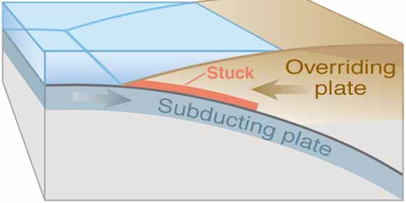
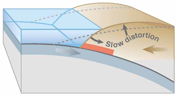
The plates do not always slide smoothly and can get stuck on one another. When this happens, great pressure is slowly built up and the continental crust can get pushed back and upwards.
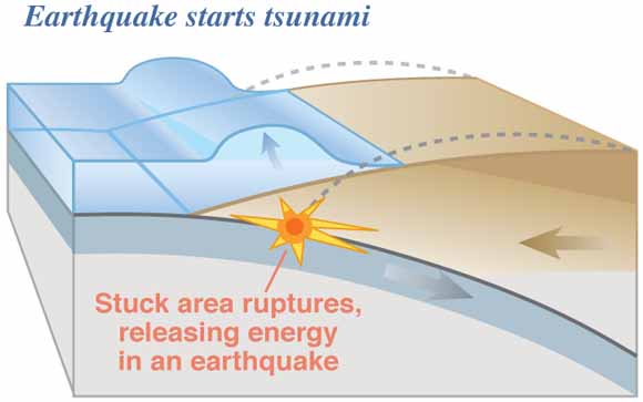
When the pressure builds up so much that the stuck portions can no longer hold, it releases suddenly. This is an earthquake.
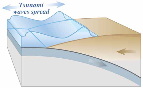
The portion of the continental crust that had been bent upward, springs back into its previous location and pushes all that water out of its way. That pushed water is the Tsunami, which then travels out across the ocean and on to land.